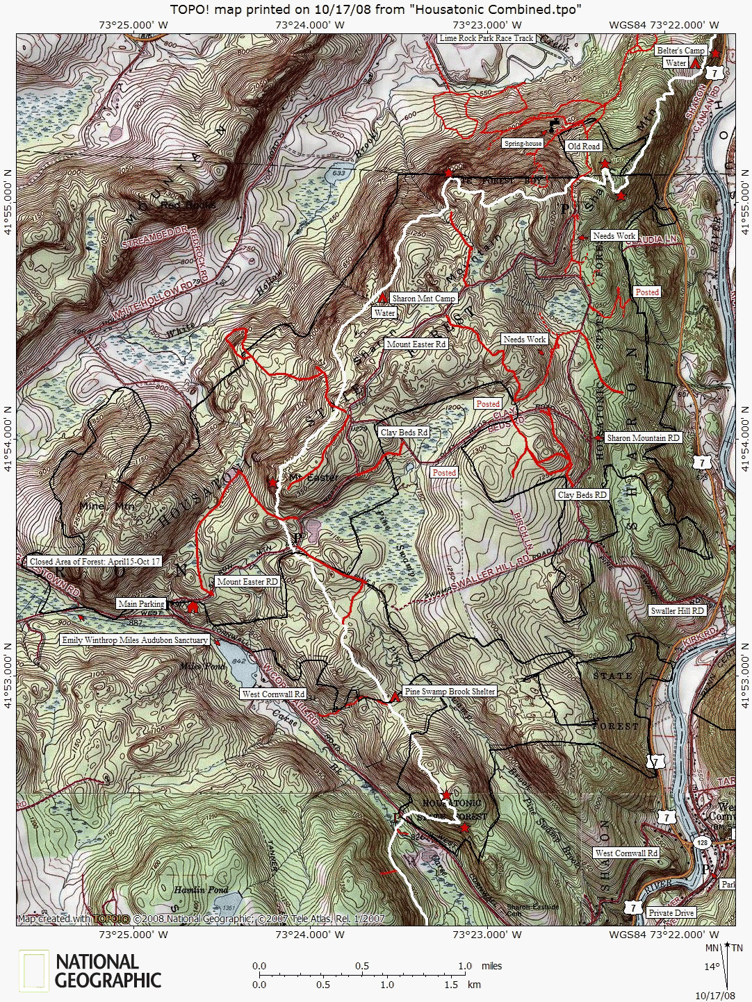

Housatonic State Forest, Sharon Mountain Trail Map
Connecticut Explorer's Guide has done it again! We mapped out every portion of this area so the general public can hike or snowmobile without getting hoplessly lost.
This area is a designated snowmobile park with most of the red trails representing the routes. Even so, there are a few trails marked with, "Needs Work," because there are what appears to be 10 years worth of fallen trees blocking the route. Besides the snowmobile trails, the Appalachian Trail (in white) passes through.
The Sharon Mountain area is another example of how the CT DEP has fallen short with providing maps to the public. The only DEP map available for the Housatonic State Forest is a snowmobile trails map that doesn't even accurately plot the routes. Not only is the DEP misrepresenting trails, but they are negligent with the safety and well-being of their trail users.

