Metacomet Hiking Trail South
The Metacomet Trail is a fairly nice hike and offers a great variation of geologic terrain versus the Mattabesett Trail. Even though the Metacomet lacks rugged granite outcroppings, it makes up for it with astonishing vistas and more mountainous treks. It could also be regarded as the official rock-climbing trail for Connecticut with dozens of impressive cliffs and high rock walls.
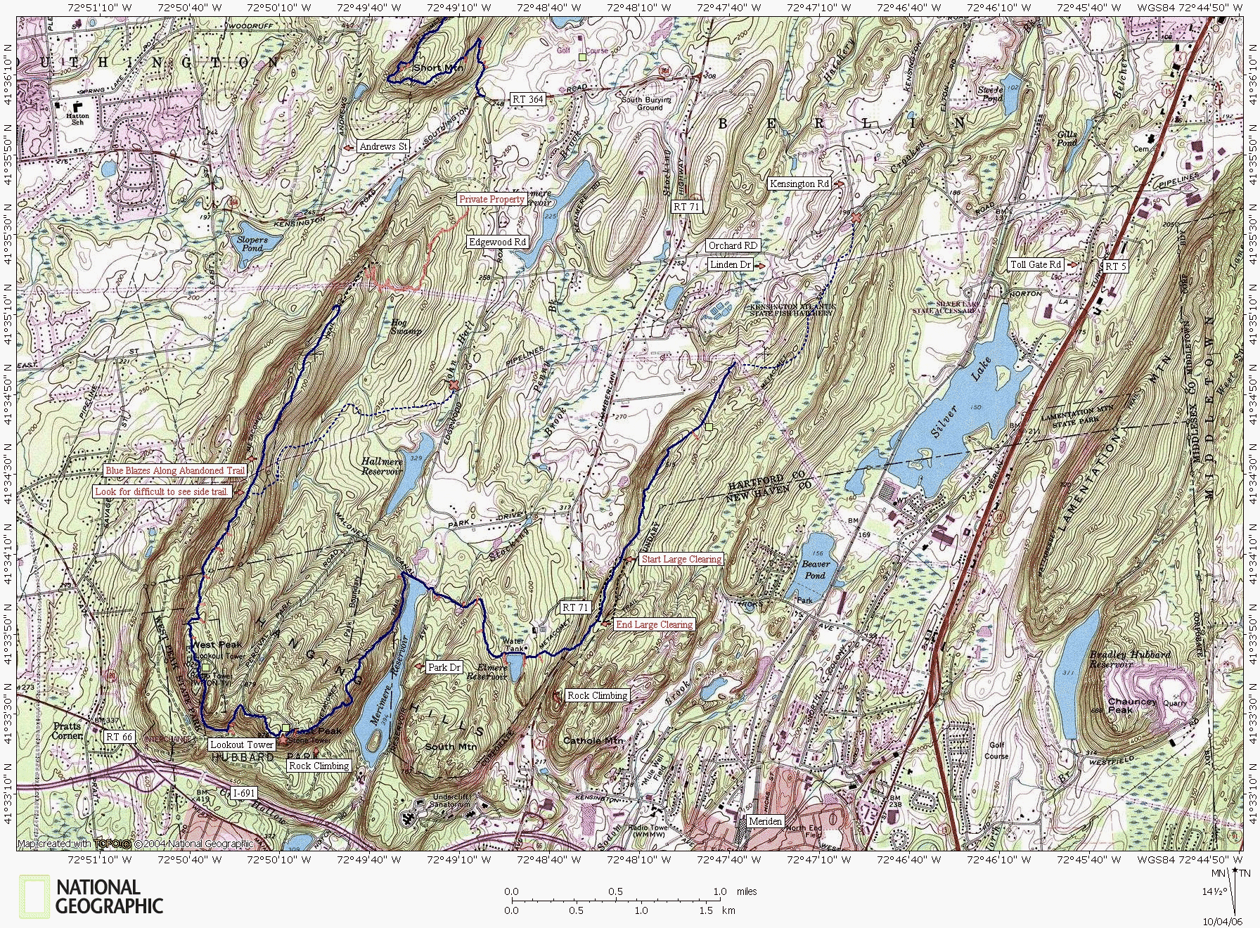
The trailhead begins at the easternmost red X, but there is no parking at that location. There are many trailheads that are nearly impossible to access because of no-parking zones and a few old abandoned trails still have their blue blazes which is cause for concern.
You must park road-side along Summit Wood Dr just befor the cul de sac or if you have a jeep you can park on the curb at the high tension power lines. The hiking through this first section is a bit odd because it runs right through a residential neighborhood and feels like trespassing. The Hubbard Park section is one of the most scenic areas with a reservoire clamped in a mountain valley and a look-out tower that is perched on the edge of the highest point along the entire east coast! Beware of the hike along the ridge of West Peak; there is an abandoned portion of the trail that still has it's blue blazes. The "official" blue-blazed Metacomet Trail supposedly turns right just before the pipeline cut. If you miss it, follow the pipeline cut down the east side of the ridge. The next section can be found by turning left off of Edgewood Rd onto RT 364 and turning right at the end of the golf course.
Summit Wood Dr
www.nationalgeographic.com/topo
Map created with TOPO! copyright 2006 National Geographic
Trail data created by CTXGuide.com copyright 2006

Next Map
As with all of the other trail maps, the red trails represent unmarked trails and the red trail stubs represent unexplored trail intersections or splits.


